Irfik
| Population: | 446,593,300 |
| Mean Distance from Epsilon Indi: | 31,480,000 m |
| Distance from our solar system: | 12 Light Years |
| Orbital Period: | 1 y, 364 d, 8 h |
| Eccentricity: | .04447 |
| Rotational period/day length: | 49.3 h |
| Circumference: | 28,445.018 km² |
| Surface area: | 296,415,100 km² |
| Axial tilt: | 14° |
| Mass: | .586 earth masses |
| Gravity: | 0.99987 g |
Irfik is an extra-solar planet which orbits the star Epsilon Indi [1] in the constellation of Indus [2] about 12 lightyears away from earth. It was discovered in 2056 shortly after Sheerflight travel was invented.
It consists of two large continents, 14 countries and one small, uninhabited volcanic island. It is home to about two billion people, who speak one of Sixteen indigenous languages.
Irfik also is home to 4 indigenous religions and two that have been imported, shall we say, from it's earthly visitors, Christianity and Islam. The indigenous religions are Solarriam, Mastalis, Vekun and the fourth Divismalah, a small minority religion.
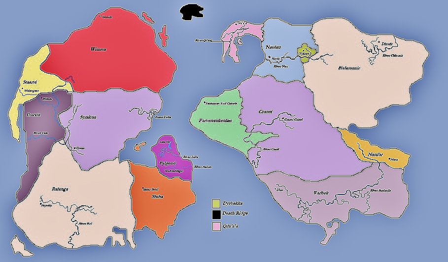
Of the fourteen countries, Bislamanir is by far the largest and most industrialised, the capital of which is Dirsthir (Bis: Дусту). The official language is Bisla'ikh
The smallest country is a neighbour of Bislamanir's, Dyrbekka, who's capital is Tyćen (Dyr: Tykcen)
The uninhabited island goes by many names in the languages of Irfik, most agree on a certain morbidity to the name, the English speaking inhabitants call it 'Death Ridge' as it is a morbic, black, tarry, cliffy land. Of the twelve voyages in Irfek's history to Death Ridge, only 2 have ever come back. Little is known about the island, but many community legends have been created about it. More information some of the stories and mythologies surrounding the island can be found here
The countries of Irfik
Countries Of Bismic Continent in order of Size:| Country | Official Language | Capital City | Rounded Population |
| Czansi | Czanak | Czansi Cziszi | 31,500,000 |
| Bislamanir | Bisla'ikh | Dirsthir | 134,260,500 |
| Vorbek | Vorb | Ulan | 31,500,600 |
| Porvenaukenlan | Porven Chili | Sachaman Voti Calvein | 10,100,100 |
| Naulau | Nauli | Navia | 10,240,500 |
| Nanfor | Nanforish | Nana | 1,990,000 |
| Qila'a'o | Qi | Na'a'o | 2,240,000 |
| Dyrbekka | Dabba | Tykcen | 950,000 |
| Country | Official Language | Capital City | Rounded Population |
| Ralanga | Rolo | Shyrdiŋ | 109,160,000 |
| Wimna | Wimnish | Gitinik | 28,000,100 |
| Syrakon | Sysh | Urvan | 28,250,500 |
| Durvia | Durvish | Bilřala | 15,400,500 |
| Shiha | Austar Îr | Shiha Îbinî | 3,400,500 |
| Staervi | Stish | Malangaso | 14,200,000 |
| Fylgenó | Fyló | Istabladdagat | 5,400,000 |
The two other minority languages are a strong dialect of Bisla'ikh called Bisa, and there are a few sparse colonies of settlers and natives who speak English as a first language.
What year is it?
The Irfik calendar is used according to our rules, a year is one solar orbit, a day is one axis orbit, however, since the year and day on Irfik are just about twice that of Earth, you must half the year. So to us, Irfik was discovered in 2056, whereas to the inhabitants of Irfik, it would have been 1028.
Continents
Irfik has two Continents. This Bismic Continent and the Ranga Continent. Below is an image of the Irfik World Map, it shows the countries, their capitals and a few major rivers.
The black country at the top is Death Ridge, the unhabitable volcanic island.
Rivers, Lakes and Seas
The continents are surrounded by one ocean which is know to the Irfikans as many names, dependig on which language you are speaking and which part of the world you are in. For example, Qilans call the sea the Ra'vi'i sa'afa'a or Cold Expanse (Qila'a'o is similar to Earth's Norway).
Fylgenans call the sea Yna Mellman or The Turquoise, due to their warm climes and barrier reefs.
The largest river on Irfik is the River Senlanjis, which completely bisects Vorbek, although it's source starts in the mountains of Nanfor in the Mila Mountains, which is a national park. The river also has a tributary that supplies the Vorbekian capital, Ulan, with water.
The River Cale supplies three capitals on it's meandering journey throught the countries of Durvia, Wimna, Staervi, Syrakon and Ralanga.
Another national park is the Syrakonese Suma Delta. This gigantic protected area is a wildlife sanctuary and is home to several species of birds not found anywhere else on the planet, such as the Tikalal.
Images of Irfik
Images attributed to Andrew Savu, who took the pictures whils holidaying on Irfik.
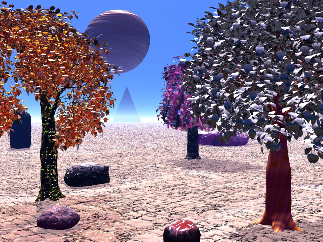
Andrew was an avid explorer, and during the 2070's, took great interest in the lands of Irfik, Particularly of Qila'a'o (eventually marrying a Qilan in 2081) and of Ralanga. Below is one of his most prized pictures, a rare passing of Ykma Hu, the Gas Giant planet that orbits around Epslion Indi with Irfek, but with a hugely eccentric orbit. The picture was taken in the Southern Stretch, a Ralangan desert, home to the rare 'glass trees', trees that have developed highly reflective, almost crystal like leaves that absorb energy from the host star.
The tree's are by far a protected species. In the Distance, you can make out the administerial capital biulding, a huge steel pyramid, where the governing of Ralanga takes place. It is on the edge of Southern Shyrdiŋ.
This second picture was taken on the coast of the Gulf of Hae Ţôn, a City in suthern Staervi. It was taken at night and shows a quiet inlet in the folds of the valleys. Rumour has it that Andrew had build a small log cabin in this part of Staervi, where he would Holiday with Mila'an, his Qilan wife.
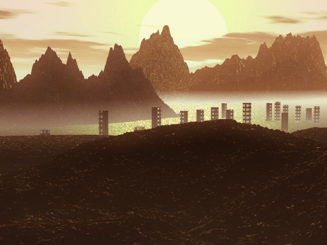
Another significant place to Andrew was the city of Gitinik, the Capital of Wimna. Andrew worked as a photographer for a local monthly supplement about current issues and he took this picute from Salu Mountain. he said of it: ...The sunsets in Gitinik are among the most striking imaginable, the lowlying fog in the valley makes for an atmospheric and breattaking scene.


